


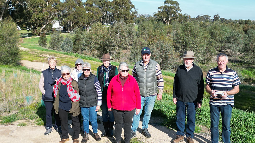
Sunny winter days make for perfect weather to head out to explore local wetlands, with the recent rain and a hint of spring around the corner seeing them come alive with birdsong and frog calls. On a recent Sunday, members of Avon Plains Banyena Landcare and the wider community did just that, heading out to the Rupanyup area on Wotjobaluk Nations Country.
Mutton Swamp is a short drive south of Rupanyup, and was originally set aside to be the town’s water supply. Brown Treecreepers, a species listed as vulnerable, were seen hopping along Black Box trees, many of which were planted when the area was declared a wetlands in 1987.
Mutton Swamp receives environmental water from the Wimmera Mallee Pipeline, benefitting local vegetation and wildlife. An Australasian Grebe met us on the water in the middle of the reserve, where the group heard from local birding expert Ian Morgan, who said that critically endangered Swift Parrots had been seen at Mutton Swamp this time last year.

The next stop was Rupanyup Reservoir, situated on the northwest corner of town, where the decommissioned water supply area has been converted into a thriving forest and space for the community.
Rupanyup Landcare member Adrian Tyler, who is largely to thank for turning the reservoir site into what it is today, lead the group on a leisurely walk around the circuit track.
Brown-Headed Honeyeaters and Singing Honeyeaters were observed enjoying a landscape filled with thousands of native trees and shrubs (both local and non-local species), many of which Adrian propagated from seed he collected. Adrian continues to undertake planting and weed maintenance of the site, and over the years has spent countless volunteer hours improving the area, including building a footbridge and spreading tonnes of gravel by hand.

After a picnic lunch at Jack Emmett Billabong, the group headed to Jack’s Track, which meanders through Black Box and Lignum toward a wetland and woodland area.
Beginning behind the old Rupanyup Flour Mill, where the first concrete silos in Australia were built, Jack’s Track is on private land that has been opened up for the benefit of community and environment, with Adrian Tyler again playing a large role in its establishment, planting and ongoing maintenance. Converted from a site that in 2005 contained only a single Black Box tree, and where a sand quarry was once used to source materials for the town’s concrete silos, it is now a revegetated wetland that serves both ecological and community purposes. A White-Faced Heron, Australasian Grebes, Eurasian Coots and Pacific Black Ducks were observed enjoying the series of dams, which help filter water on its last stop in the town’s water treatment journey, before being put to use on the local footy oval.

Weather conditions are ideal at the moment for getting out in the winter sunshine to appreciate our local environment, or to get plants in the ground, and there are many Landcare activities happening around the district that community members are always welcome to attend. The next Avon Plains Landcare event is a visit to Dalki Garringa Native Nursery in Wail on Wednesday 22 July at 10am, all welcome.
Contributed by Alana Rivera Kingston, Yarrilinks Landcare Network

- Mar 1, 2019
Updated: Jun 4, 2025
Wednesday 20th Feb 2019 saw several members from St Arnaud Field Nats and Avon Plains Banyena Landcare Group leave the boat ramp for a round-the-Lake bird survey. Beautiful clear, sunny and cool weather kept any pesky insects at bay and we spent 2 1/2 hrs watching birds and listing them for Birdlife Australia's online Bird Atlas. Walker's Lake, north-west of St Arnaud, one of the waterbodies in the highly significant Avon Plains Lakes system.

30 species were seen, mostly waterbirds or landbirds that are associated with wetter environments such as Magpie-larks. For first part of our walk, through Black Box Woodland to the western end of the lunette, we were accompanied by a small family of Black-fronted Dotterels, moving like little clockwork toys along the insect-laden edges of the water. Moving with the BF Dots, but staying in front of the pack was a pair of Red-kneed Dotterels. You can see the red knees in this on-the- move long telephoto shot by Prue McAllister (APBLG).

Up onto the lunette( a huge sandbank, formed over thousands of years from pelleted clay blown from the lake bed during dry,cold spells) and the bird assembly changed- Welcome Swallows and White-plumed Honeyeaters foraged busily above or in the massive Redgums, Galahs and Long-billed Corellas defended their nesting areas; the Redgums are full of hollows, indicating their great age (150 year of growth before hollows begin to form). From our vantage point we spied a raft of Australasian Darters, diving and fishing in the shallow waters, almost like a choreographed water ballet- all up, then one after the other, down again! It was hard to count how many there were. Male Darter in breeding array Photo A Hughes StAFNC

Several smallish rafts of ducks were seen a good distance away- photos later revealed Pacific Black Ducks, Grey Teal, one lonely Hardhead, the pretty little Pink-eared Ducks and wonder of wonders, a group of 4 Australasian Shovelers, a protected species during the duck shooting season, and not unlike the Pinkies in profile( strange bills) but larger and with more distinguishing marks- white patch and dark rump. This group included 3 males and one female and the very long shot was taken again, by Prue McAllister.

Coming around to the inlet area, we were escorted along the shoreline by a Sacred Kingfisher, nervous of our presence but reluctant to leave us to our own devices for some reason. Photo by Anne Hughes StAFNC

Moving along the southern shore, through the Redgums and Black Box, we spotted 4 White-breasted Woodswallows using the fenceposts as perches.
They were not interested in posing for the cameras but the photos were good enough for identification purposes. White-breasted Woodswallows are seen at the Lake mostly during Summer.
This pair behaved like juveniles, waiting for parents to return with a meal.

Food was certainly on our minds as we completed the 3km walk and headed for our morning tea- the usual relaxed and enjoyable end to our outings at the lake.